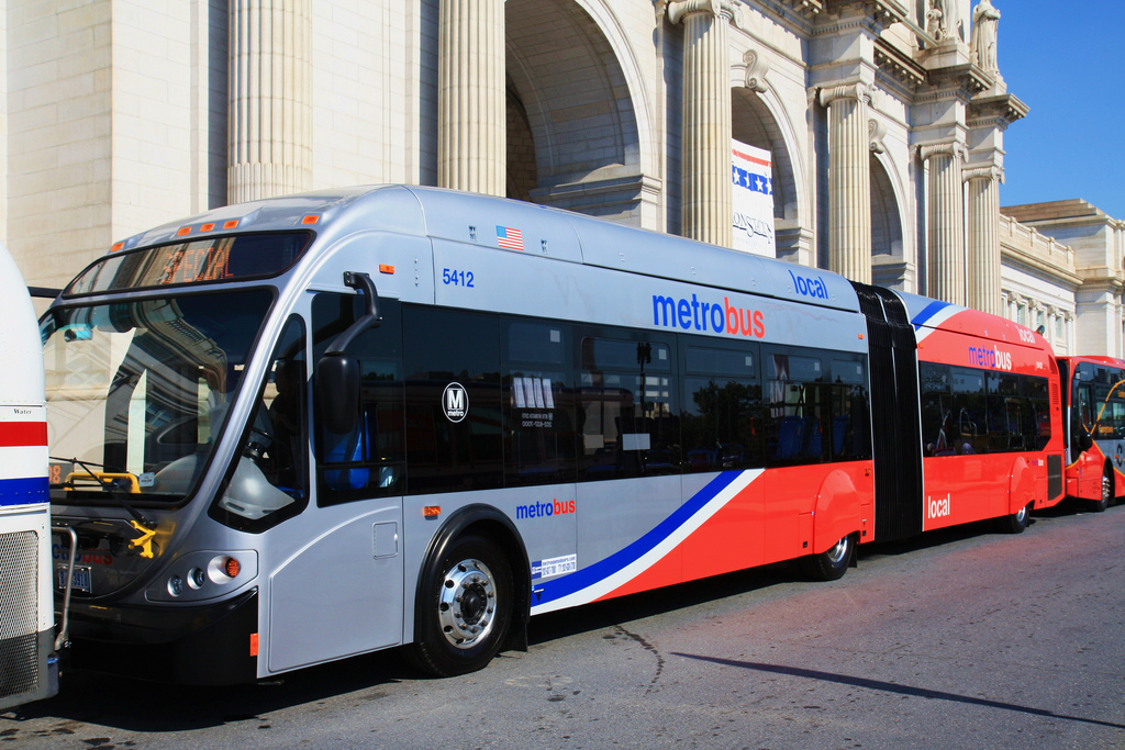
A Metrobus at Union Station. (Photo by Mr. T in DC via CC BY-ND 2.0 >>)
During a job interview roughly a decade ago, my future managing editor asked me if I had any side projects or interests. I told her that I wanted to create a D.C. bus guide, a kind of transit tipsheet or handbook.
“That’s a great idea. I could use that,” she said.
I never got around to it.
Ten years later, after countless bus trips around the nation’s capital, I’ve finally gotten around to writing down and organizing my tips, suggestions, short cuts and observations of D.C.’s bus system. I’ll be updating and expanding my D.C. Bus Guide as the system evolves.
A few brief disclaimers: This guide is in no way officially affiliated with the Washington Metropolitan Area Transit Authority, the D.C. government or any other local entity. The information in this guide is based on my own observations of bus transit in D.C. as a rider and official transit information published by WMATA and the D.C. Circulator. Whenever possible, I’ll link to official information. All the information was accurate to the best of my knowledge at the time I wrote this guide. If you spot errors or confusing information, I will make my best effort to correct and improve what I’ve written.
Have fun getting around town!
—Michael E. Grass, December 2013
» JUMP TO D.C. ROUTE PROFILES:
31 | 32 | 34 | 36 | 37 | 38B | 39
42 | 43
52 | 53 | 54
60 | 62 | 63 | 64
70 | 74 | 79
80 | 81 | 82 | 83 | 81 | 86
90 | 92 | 94 | 96 | 97
A2 | A6 | A7 | A8 | A9 | A42 | A46 | A48
B2
D1 | D2 | D3 | D4 | D5 | D6 | D8
E2 | E3 | E4 | E6
G2 | G8
H1 | H2 | H3 | H4 | H6 | H8
L1 | L2
M2 | M4 | M6 | M8 | M9
N2 | N3 | N4 | N6
P6
S1 | S2 | S4 | S9
U2 | U4 | U5 | U6 | U8
V5 | V7 | V8 | V9
W2 | W3 | W4 | W9
X1 | X2 | X1 | X8 | X9
D.C. Circulator: Georgetown-Union Station
D.C. Circulator: Dupont Circle-Georgetown-Rosslyn
D.C. Circulator: Woodley Park-Adams Morgan-McPherson Square
D.C. Circulator: Union Station-Navy Yard
D.C. Circulator: Potomac Avenue-Skyland
(Other route profiles are under construction …)
A section of WMATA’s complex bus system diagram …
THE BASICS:
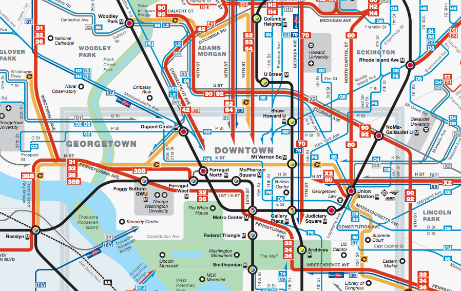
To newcomers to the nation’s capital, the bus system might seem confusing. (Well, it is! Just look at the system diagrams.) There’s no primary bus hub. (There are lots of them.) Some routes twist and turn is strange ways. 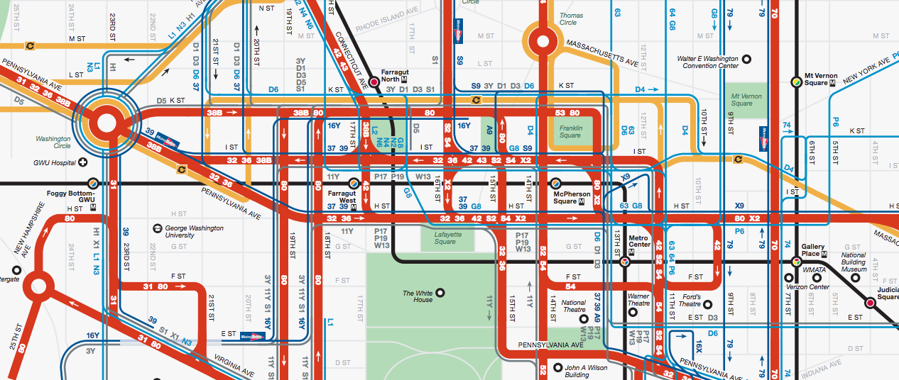 Just look at the mind-boggling diagram of the tangle of bus routes downtown, pictured at right. (It’s awfully intimidating. Right?)
Once you understand how to use the bus system to your savvy advantage, you can make your daily commute, jaunts around town and other street-level explorations — painless. Or in the very least, the least painful as they can be …
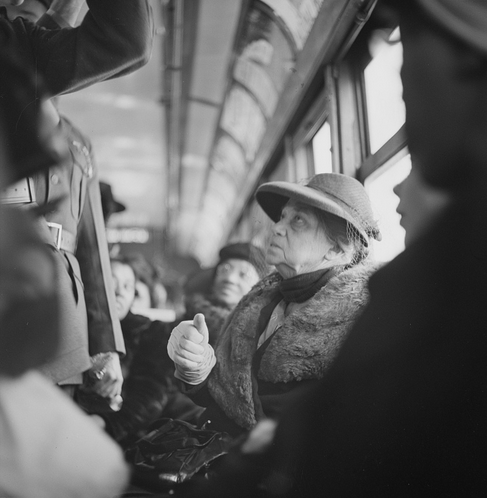
A woman riding a streetcar in the nation’s capital in 1943. (Photo by Esther Bubley/U.S. Farm Security Administration via Library of Congress >>)
The origins of the bus system are rooted in the former streetcar network that crisscrossed the District of Columbia before its final route was decommissioned in 1962. The rubber-tired system that eventually took its place, Metrobus, has grown into a critical part of moving people around the District and in the Maryland and Virginia suburbs.
The larger local bus network, which includes the D.C. Circulator system, extends well beyond the Metrorail system. But it also connects bus commuters to the rail network, which will soon include the new Silver Line, launching service in 2014. Since most Metrorail stations are also Metrobus transfer points, many Metrorail commuters are bus commuters as well.
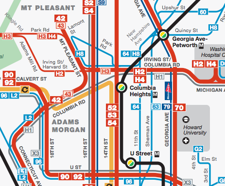
There are plenty of bus options through Columbia Heights … (via WMATA)
Knowing a few tricks of how the system works can make getting from Point A to Point B relatively painless. (Sometimes!) And if you check bus-arrival predictions, you can make more informed transit decisions en route to your destination depending on traffic conditions. Hopping a bus can also be incredibly helpful on weekends when parts of the Metrorail system may have limited service or are shut down for ongoing rehabilitation work.
In my DC Bus Guide, I hope to explain basics and relay some helpful tips, learned from years of riding the bus around the nation’s capital. Once you know the peculiarities, shortcuts and major bus routes, you’ll have more options in your public transit tool belt.
My guide will primarily focus on the District of Columbia. (Sorry Maryland and Virginia.)
FARES AND PAYMENT:
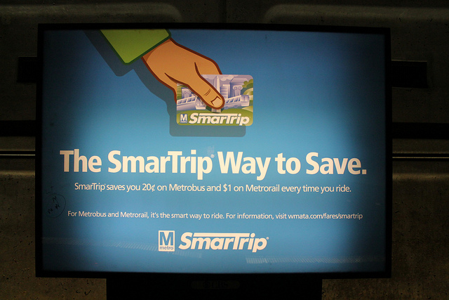
SmarTrip is usually your best payment option. (Photo by Flickr user Elvert Barnes via CC BY-SA 2.0 >>)
» While you can pay Metrobus fare using U.S. paper currency and coins, it is in your financial interest to pay with an electronic SmarTrip card, which can also be used on Metrorail, D.C. Circulator, suburban bus systems (Alexandria DASH, Montgomery County Ride On, Fairfax Connector, Fairfax CUE, Arlington County ART, Loudoun County Transit, PRTC Omniride, Prince George’s County TheBus) and the Maryland Transit Administration local buses and Baltimore’s Metro Subway and Light Rail routes. Metrobus charges higher fares for passengers not paying with SmarTrip ($1.60 vs. $1.80). Metro charges higher fares on certain express and airport bus routes. Read the fine print.
» Metrorail paper farecards can’t be used on Metrobus. (Using a paper farecard also result in a $1 surcharge for each Metrorail trip. Get the hint? Buy a SmarTrip card and everyone wins!)
» Regular fares for D.C. Circulator bus trips are $1 per ride. Using a SmarTrip card, transfers from Metrobus and Arlington ART buses are free within two hours. Transfers from Metrorail using a SmarTrip card are 50 cents. Read the fine pint.
» Purchasing a SmarTrip card requires a cost $5 each, can be purchased and be reloaded with more money at Metrorail stations, Metro sales offices and at select retailers.
» More on Metrobus fares and passes …
» More on SmarTrip …
The X2 bus stops at 7th & H streets NW in Chinatown. (Photo by Flickr user ep_jhu via CC BY 2.0 >>)
FARES AND PAYMENT TIPS:
» If you aren’t paying with SmarTrip, have exact change ready when you board. Bus operators do not make change. Please remember that since the vast majority of D.C. bus commuters use SmarTrip cards, you’ll be stared at by your fellow passengers if you’re fishing and fumbling for exact change in your pocket. (Translation: You’re delaying the bus!)
» If you are paying with SmarTrip, wave the card over the circular sensor on the fare machine next to the bus operator. The SmarTrip sensor makes two distinct sounds when tapped. A friendly-sounding beep means that the proper fare or transfer was taken from the SmarTrip card. Then there’s the mean-sounding buzzing sound. The sensor can act up so don’t freak out. It can take a few taps for the sensor to recognize the card. The bus operator will probably say “try again.” So try again! Hopefully, there’s enough money on your SmarTrip card and the sensor will eventually give you the friendly beep of success. Go sit down now.
» Try to avoid reloading your SmarTrip card with money when boarding a bus. (Reload your SmarTrip card at a Metrorail station whenever possible. Or even better, if your employer offers transit benefits, you can have it automatically reload monthly onto your SmarTrip card. Voila! Technology works. Usually.)
» The process for reloading SmarTrip card with cash onboard can be confusing and time consuming. Bus operators hate to explain it or hand-hold passengers through the process. One incorrect step in the process could mean your $10 or $20 bill could get sucked up into the farebox without actually being applied to your card!
» When the SmarTrip sensor isn’t working properly, the bus operator will sometimes just wave you through, especially when there’s a long line of passengers waiting to board. Just do what the bus operator says and everything will be cool!
TRANSFERS:
Metrobus eliminated paper transfers in January 2009 to encourage use of SmarTrip cards and help curb fare evasion. So if you’re using a dollar bill and exact change as bus fare, you’ll have to pay a new fare when transferring to a new bus route.
» Using a SmarTrip card on Metrobus allows a two-hour travel window to transfer to other bus routes for free. Using a SmarTrip card will also factor in the discount for transferring to and from Metrorail and other local transit services, including Metrobus, and D.C. Circulator.
» The two-hour transfer window is good for round-trip journeys. So, if you have a few geographically-adjacent errands you need to get done or want to grab a bite to eat in a different neighborhood, you often can go there and back – or somewhere else in between — for the cost of one bus fare. You often get more bang for the buck while riding Metrobus.
» Complete Information on Transfers …
METROBUS ROUTE NUMBERING:
In the District of Columbia, Metrobus routes are either numbered (e.g., the 42 bus ) or have a lettered prefix (e.g., the D6 bus). As with Southern California freeways, in D.C. casual conversation, we apply the article “the” before saying the route number and then end with “bus” (e.g. “the 42 bus”). Bus routes are rarely referred to by their formal line name. (For instance, although the 42 bus terminates in Mount Pleasant, nobody really calls it the Mount Pleasant Line, which is also a historic reference to the former streetcar route of the same name.)
The numbered buses are remnants of the former streetcar system, retaining the numerical route identity. These numbered routes are often clustered in series and share much of the same transit corridor, though they may have different starting or destination points, plus other variations in routes. For instance, the 30-series buses, comprised of the 31, 32, 34, 36, 37 and 39 buses are all part of the crosstown Pennsylvania Avenue bus corridor. Each individual route in that series has a different service pattern, meaning there could be a different destination, hours of operation or section of the overall route served.
Lettered routes run in similar series. For instance, the H2, H3 and H4 buses form the Crosstown Line between the Tenleytown Station (Red Line) and Brookland Station (Red Line), though their specific routes have slight variations along the same bus corridor.
A particular bus route number does not signify a corresponding street on D.C.’s grid of numbered and lettered streets. So, for instance, the U buses don’t run on U Street. You just have to know where they all go …
METROBUS ROUTE PROFILES:
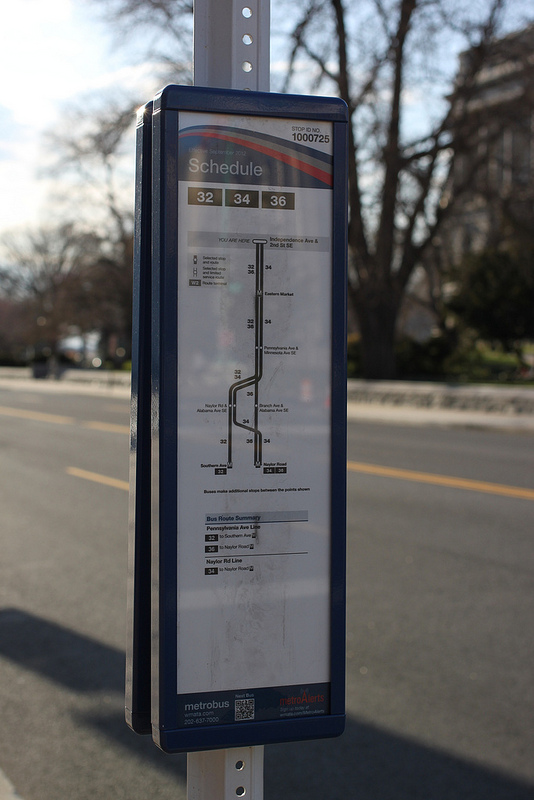
A bus stop for the 32, 34 and 36 buses at 2nd Street SE & Independence Avenue. (Photo by Oran Viriyincy via CC BY-SA 2.0 >>)
The 30s
The 30s, comprised of the 31, 32, 34, 36, 37 and 39 buses, serve parts of the all-important crosstown corridor formed by Pennsylvania Avenue and Wisconsin Avenue. These buses are among the most heavily used in the nation’s capital. While the corridors along Pennsylvania Avenue and Wisconsin Avenue technically offer frequent bus service, they often bunch up and play leap-frog along their routes. Metrobus introduced limited-stop express service (the 37 and 39 buses) along portions of the route and is studying options to improve service, including detouring some crosstown routes to avoid congested areas like Georgetown.
For tourists, taking the 32 or 36 buses between Capitol Hill and the National Cathedral can offer a cheap sightseeing trip across the National Mall, through the heart Pennsylvania Avenue and Georgetown.
The 31 bus serves the northwestern section of the larger 30-series crosstown bus route (Pennsylvania Avenue Line) connecting the Friendship Heights Station (Red Line) and Foggy Bottom Station (Blue/Orange/Silver lines) via M Street NW in Georgetown and Wisconsin Avenue through the Upper Northwest neighborhoods of Glover Park, Cathedral Heights and the Tenleytown Station (Red Line).
- Beware of congestion through Georgetown on Wisconsin Avenue and onboard Metrobus, including weekends when shoppers crowd the intersection of Wisconsin Avenue & M Street NW.
- Inbound on weekday mornings, buses are packed to the gills, especially from Calvert Street NW southward.
- Heading to the Glover Park, Cathedral Heights or McLean Gardens neighborhoods from Foggy Bottom? Stand at the northeast corner of 24th Street NW & Pennsylvania Avenue. At that spot, the 31 bus joins the 32 and 36 buses before heading through Georgetown. Since they all follow the same route to Friendship Heights, you can hop of whatever bus comes first.
» Complete 31 Route Information [WMATA]
32/36: Pennsylvania Avenue Line
The 32 and 36 buses run across town via Pennsylvania Avenue and are among a few full crosstown routes in D.C. The 32 and 36 buses have their western terminus at the Friendship Heights Station (Red Line), a major Metrobus transfer point, and have their eastern termini east of the Anacostia River at the Southern Avenue Station (32 bus) and the Naylor Road Station (36 bus). The rest of the route is shared, using Wisconsin Avenue through Tenleytown, Cathedral Heights, Glover Park and Georgetown, Pennsylvania Avenue, 7th Street NW, 7th Street SW, 15th Street NW, H Street NW, I Street NW and Independence Avenue to cross downtown and Capitol Hill.
- This route serves many Metrorail stations, including Friendship Heights Station, Tenleytown (Red Line), Foggy Bottom (Blue/Orange/Silver lines), Farragut West (Blue/Orange/Silver lines), McPherson Square (Blue/Orange/Silver lines), Federal Triangle (Blue/Orange/Silver), Archives (Green/Yellow lines), Eastern Market (Blue/Orange/Silver lines) and Potomac Avenue (Blue/Orange/Silver lines). Some bus trips on the 32 and 36 route terminate at the Tenleytown and Foggy Bottom stations.
- When traffic is tied up downtown and near the White House during a weekend evening commute, riders on the 32 and 36 bus routes often suffer. It’s Washington gridlock at its worse. But on weekends, when the Orange and Blue lines might be disrupted for ongoing rehabilitation, these buses can offer quick alternatives through the heart of downtown.
» Complete 32 and 36 Route Information [WMATA]
The 34 bus connects the Naylor Road Station (Green Line) in Prince George’s County with the Archives Station (Green/Yellow lines) via Skyland, Naylor Road, Pennsylvania Avenue, Independence Avenue, 7th Street SW and 7th Street NW.
- The 34, like the 32 and 36 buses, can get stuck in traffic on Pennsylvania Avenue, particularly around the John Phillip Sousa Bridge.
» Complete 34 Route Information [WMATA]
37: Wisconsin Avenue Limited Line
The 37 bus is a limited-stop route connecting the Friendship Heights Station (Red Line) and Archives Station (Green/Yellow lines) via Wisconsin Avenue and Massachusetts Avenue through Embassy Row.
- By skipping Georgetown, this route can give bus riders in Cathedral Heights, McLean Gardens, western Cleveland Park, Tenleytown and Friendship Heights a faster trip between their Upper Northwest neighborhoods and points downtown.
- This route only runs downtown (toward Archives) in the morning and outbound (to Friendship Heights) during the afternoon. The route serves the Farragut West Station (Blue/Orange/Silver lines) and McPherson Square Station (Blue/Orange/Silver lines) via H and I streets NW.
- This bus is great for commuting, especially the stretch between the National Cathedral and Dupont Circle with no stops. But it only runs on 15-minute headways and only during the morning and evening commute.
» Complete 37 Route Information [WMATA]
38B: Ballston-Farragut Square Line
The 38B is the only Metrobus route offering frequent service across the Potomac River between Arlington County and the District of Columbia. Connecting Farragut Square and Ballston Station (Orange/Silver lines) via M Street NW in Georgetown, Key Bridge and Rosslyn Station (Blue/Orange/Silver lines), this bus can be particularly valuable when the Orange Line is disrupted through Arlington County’s Ballston-Rosslyn corridor.
- It’s sometimes referred to as the “Orange Line With a View.”
- The 38B can also provide a quicker and less crowded trip to and from the heart of Georgetown on M Street NW compared to the often-packed D.C. Circulator buses through Georgetown.
» Complete 38B Route Information [WMATA]
39: Pennsylvania Avenue Limited Line
Just like the 37 bus, its companion on the other side of town, this limited-stop MetroExtra route connects downtown with the Naylor Road Station (Green Line) via Pennsylvania Avenue.
- Like the 32 and 36 buses, beware of congested traffic conditions at the John Phillip Sousa Bridge and downtown.
» Complete 39 Route Information [WMATA]
The 42 bus is among the most heavily used routes in D.C. and connects the Mount Pleasant neighborhood and Metro Center via Connecticut Avenue and Columbia Road through Adams Morgan and Dupont Circle with connections to the Farragut North Station (Red Line), Farragut West Station (Blue/Orange/Silver lines), Dupont Circle Station (Red Line), Metro Center Station (Red/Blue/Orange/Silver lines), McPherson Square Station (Blue/Orange/Silver lines).
During the morning peak period, the 43 bus adds additional service to the 42 route, and skips stops near Dupont Circle by using the Connecticut Avenue underpass. During the evening peak period, the 43 runs in the opposite direction.
- By skipping Dupont Circle, the 43 can avoid traffic congestion the 42 can often encounter going around Dupont Circle. If you start or end your journey in the vicinity of 18th Street NW & Columbia Road in Adams Morgan, you can also take the L2 bus to skip Dupont Circle via the Connecticut Avenue underpass.
- Don’t want to walk to Adams Morgan from Dupont Circle (Red Line)? Take the 42 bus instead. For service to 18th Street NW & Columbia Road, simply wait at the southeast corner of Connecticut Avenue & Q Street NW or any northbound bus stop along Connecticut Avenue near the circle.
- Although the 42 bus does not offer a direct transfer to the Columbia Heights Station (Green/Yellow lines), the bus stop at Mount Pleasant & Irving streets NW is within a 5-minute walk of the Metrorail station entrances at 14th & Irving streets NW.
» Complete 42 and 43 Route Information [WMATA]
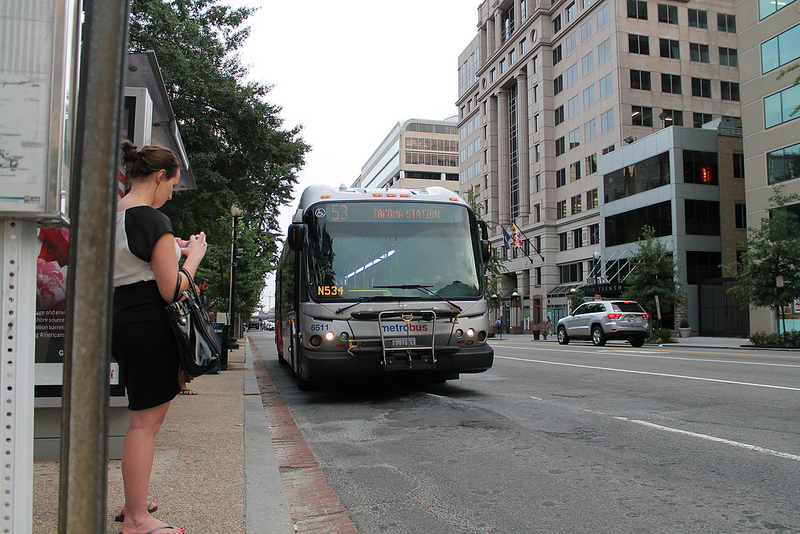
A Takoma-bound 53 bus at 14th & K streets NW. (Photo by Flickr user Elvert Barnes via CC BY-SA 2.0 >>)
The 50-series buses on 14th Street NW provide frequent north-south service through the heart of the city connecting the L’Enfant Plaza Station, (Blue/Orange/Silver/Green/Yellow lines) and McPherson Square Station (Blue/Orange/Silver lines) with the Takoma Station (Red Line) via 14th & U streets NW and the Columbia Heights Station (Green/Yellow lines). The Metro Center Station (Red/Blue/Orange/Silver lines) entrance at 13th & G streets NW is one block east of the 50-series buses on 14th Street NW.
- Like the S-buses on 16th Street NW and the 70 bus on Georgia Avenue, the 50-series buses on 14th Street NW are heavily used, especially by residents in bus-dependent neighborhoods north of Columbia Heights.
- The D.C. Circulator’s Woodley Park-Adams Morgan-McPherson Square Route offers limited-stop service on roughly 10-minute intervals along 14th Street at P Street, U Street and in Columbia Heights, bolstering bus service along the heart of the booming 14th Street corridor.
- Metrobuses and the D.C. Circulator buses on 14th Street NW can sometimes provide faster service from the McPherson Square Station (Blue/Orange/Silver lines) to 14th & U streets NW and Columbia Heights Station (Green Line) versus the Green and Yellow lines via L’Enfant Plaza Station (Blue/Orange/Silver/Green/Yellow lines).
» Complete 52 and 54 Route Information [WMATA]
60/62/63/64: Fort Totten-Petworth-Takoma Lines
The 60, 62, 63 and 64 buses all serve the Georgia Avenue-Petworth Station (Green/Yellow lines), with northern termini at the Takoma Station (Red Line) and Fort Totten Station (Red + Green/Yellow lines).
- The 62 bus runs between the Georgia Avenue-Petworth Station and Takoma Station via Georgia Avenue, Kansas Avenue and 5th Street NW.
- Only the 63 bus and the 64 bus continue south to the Federal Triangle Station (Blue/Orange/Silver lines). The 64 bus runs primarily along 11th Street NW while the 63 bus travels along New Hampshire Avenue, Sherman Avenue, Logan Circle and 13th Street NW before terminating at the Federal Triangle Station.
- The 60 bus connects the Fort Totten and Petworth stations via Upshur Street NW, Rock Creek Church Road and North Captiol Street.
- While the 60-series buses don’t offer frequent service, they can be incredibly convenient for those who utilize the 11th Street corridor or live or hang out in Petworth.
» Complete 60 and 64 Route Information [WMATA]
» Complete 62 and 63 Route Information [WMATA]
70: Georgia Avenue-7th Street Line
There’s no shortage of bus service on Georgia Avenue. It’s just that Georgia Avenue is a really long thoroughfare and bus service can be slow and sluggish on this major route connecting the Archives Station (Green/Yellow lines) and Silver Spring Station (Red Line) via the Georgia Avenue-Petworth Station (Green/Yellow lines).
- Metrobus has partially restructured the 70 bus route in recent years to introduce limited-stop MetroExtra service (the 79 bus) and a new local bus for the southern portion of the bus corridor (the 74 bus).
- Georgia Avenue bus service could see additional changes in future decades as the D.C. government plans a north-south streetcar line on or near Georgia Avenue.
- The 70 bus intersects a handful of crosstown bus lines, including the E2, E3 and E4 buses at Georgia Avenue & Kennedy Street NW and H2, H3 and H4 buses at Georgia Avenue & Columbia Road for westbound-crosstown service and at Georgia Avenue & Irving Street NW eastbound-crosstown service.
- Metrorail’s Green and Yellow lines follow or parallel portions of the 70 bus route. Use Metrorail if your starting point or destination is near the Georgia Avenue- Petworth, Shaw-Howard University, Mount Vernon Square, Gallery Place-Chinatown or Archives stations. Use the 70 bus for local service along Georgia Avenue itself, or the 79 bus, the limited-stop MetroExtra route along Georgia Avenue.
» Complete 70 Route Information [WMATA]
***
74: Convention Center-Southwest Waterfront Line
The 74 bus was created a few years ago in an effort to improve service along the long and heavily used 70 bus along Georgia Avenue and 7th Street. Service on the 70s was truncated at the Archives Station (Green/Yellow lines). The remainder of the route south became the 74 bus. The southern terminus of this route is Half & O streets SW, near Buzzard Point and Nationals Park. Its northern terminus is 6th & K streets NW, near the Walter E. Washington Convention Center.
The entire route, excluding the far southern end near Fort McNair and Buzzard Point, is paralleled by Metrorail’s Green Line, so it’s not necessarily the most useful route for efficacy. But it can be very handy for many Southwest residents.
The 74 bus is also the only surface route offering mostly direct service between the entertainment hub around the Gallery Place (Red/Green/Yellow lines) and Nationals Park via the L’Enfant Plaza Station (Blue/Orange/Silver/Green/Yellow lines), and Waterfront Station (Green Line) offering an alternative to the Green Line during the ballpark rush before and after home games.
» Complete 74 Route Information [WMATA]
79: Georgia Avenue MetroExtra Line
This limited-stop line running seven days a week along Georgia Avenue between the Silver Spring Station (Red Line) and Archives Station (Green/Yellow lines) will save you some time over the 70 bus, especially on the upper portion of Georgia Avenue from Petworth northward to the Maryland line.
» Complete 79 Route Information [WMATA]
The 80 bus route connects the Fort Totten Station (Red/Green/Yellow lines) with the Brookland Station (Red Line), Union Station (Red Line), Gallery Place Station (Red/Green/Yellow lines), CityCenter DC, the K Street NW corridor and Kennedy Center via North Capitol Street and Michigan Avenue. Its route through Foggy Bottom is kind of wacky but for neighborhoods off North Capitol Street, the 80 bus is important link downtown.
- Waiting for the Georgetown-Union Station D.C. Circulator bus on K Street NW? If the 80 bus comes by first, you might want to hop on if your destination is Gallery Place or Union Station.
» Complete 80 Route Information [WMATA]
81/82/83/84/86: Rhode Island Avenue Line
The 80-series buses on Rhode Island Avenue are fairly simple to navigate in the District of Columbia. They terminate at the Rhode Island Avenue Station (Red Line) and head northeast along Rhode Island Avenue and on into Maryland. Check Metrobus timetables for complete route and service information in Maryland.
- The 83 and 86 buses are the best way to get from the Red Line to the Route 1 Corridor in Hyattsville, Mount Ranier and Riverdale Park.
» Complete 81, 82, 83 and 86 Route Information [WMATA]
» Complete 84 Route Information [WMATA]
The 90 and 92 buses form part of the busy Metrobus corridor on U Street NW and Florida Avenue, which also includes the 96 and 97 buses that serve New Jersey Avenue and East Capitol Street.
- The western terminus for the 90 and 92 buses is Duke Ellington Bridge on Calvert Street NW, located near the busy Metrobus transfer point at 18th Street NW & Columbia Road. The eastern terminus for the 90 bus is the Anacostia Station (Green Line). The eastern terminus for the 92 bus is the Congress Heights Station (Green Line). Both buses serve Barracks Row on Capitol Hill, 8th & H streets NE, the NoMa-Gallaudet University Station (Red Line) and Georgia & Florida avenues NW.
- The 90 and 92 buses terminate at the Duke Ellington Bridge, the location of a former streetcar terminus. It’s within walking distance of the Woodley Park Station (Red Line), but is not immediately adjacent. Walk across the Duke Ellington Bridge to/from 24th Street NW & Connecticut Avenue to make the Metrorail-Metrobus connection for the 90 or 92 bus.
- Alternately, the 96 bus follows the 90 and 92 buses through the U Street NW corridor but continues west to the Tenleytown Station (Red Line) via the Duke Ellington Bridge, Woodley Park and Wisconsin Avenue & Woodley Road adjacent to the National Cathedral. On Capitol Hill, the 96 intersects the 90 and 92 buses at 8th & East Capitol streets, a few blocks from Eastern Market.
» Complete 90 and 92 Route Information [WMATA]
This local route is relatively short and links the Anacostia Station (Green Line) with neighborhoods off Stanton Road in Southeast D.C.
» Complete 94 Route Information [WMATA]
96/97: East Capitol Street-Cardozo Line
The 96 bus has a long crosstown route between the Tenleytown Station (Red Line) and the Capitol Heights Station (Blue/Silver lines) via Duke Ellington Bridge, U Street NW, East Capitol Street and the Stadium-Armory Station (Blue/Orange/Silver lines). Washington National Cathedral, Woodley Park, Adams Morgan’s 18th Street NW corridor, Shaw, Union Station, Capitol Hill and neighborhoods along East Capitol Street are served. The 97 bus operates weekday service along East Capitol Street between the Capitol Heights Station and Union Station (Red Line), skipping the Stadium-Armory Station.
- The 96 bus can offer a relatively quick trip between the U Street corridor and Union Station (Red Line) and via New Jersey Avenue.
- Due to Capitol Hill security on First Street NE adjacent to the Senate office buildings, the 96 and 97 buses have a particularly tortured route between East Capitol Street and Union Station. Nevertheless, the 96 bus can be very handy for some Hill staffers in need of a handy connection to 14th & U streets NW and adjacent areas.
» Complete 96 and 97 Route Information [WMATA]
***
A2/A6/A7/A8/A42/A46/A48 (Anacostia-Congress Heights Line)
The A-series buses connect the Anacostia Station (Green Line), Congress Heights Station (Green Line) and Southern Avenue Station (Green Line) and surrounding neighborhoods. Although they all run along Martin Luther King Jr. Avenue between Anacostia and Alabama Avenue in Congress Heights, they serve different neighborhood routes along portions of Mississippi Avenue, Naylor Road, South Capitol Street, Southern Avenue, Atlantic Street SE, Chesapeake Street SE, Sixth Street SE and Condon Terrace. See route information for details.
- The A2 bus serves United Medical Center and Southern Avenue Station (Green Line).
- The A42, A46 and A48 buses only run at select overnight times, with extended service from the Anacostia Station (Green Line) to the Archives Station (Yellow/Green Lines) via the 11th Street Bridge, 11th & M streets SE, 7th Street SW & Maine Avenue and 7th Street SW & Constitution Avenue.
» Complete A2, A6, A7, A8, A42, A46 and A48 Route Information [WMATA]
***
A9: Martin Luther King Jr. Limited Line
The A9 bus offers limited-stop service connecting Southern Avenue & South Capitol Street with the McPherson Square Station (Blue/Orange/Silver lines) downtown via Martin Luther King Jr. Avenue, the Anacostia Station (Green Line), 11th Street Bridge, Navy Yard Station (Green Line), Waterfront Station (Green Line), L’Enfant Plaza Station (Yellow/Green/Blue/Orange/Silver lines) and Archives Station (Yellow/Green lines). This bus runs only on weekdays in the peak-direction, northbound during the morning rush and southbound during the afternoon rush.
» Complete A9 Route Information [WMATA]
B2: Bladensburg Road-Anacostia Line
The B2 is a major bus route connecting the Anacostia Station (Green Line) with Mount Ranier, Md., via Pennsylvania & Minnesota avenues, the John Phillip Sousa Bridge, the Potomac Avenue Station (Blue/Orange/Silver lines), Stadium-Armory Station (Blue/Orange/Silver lines), 14th Street NE (southbound) 15th Street NE (northbound) and Bladensburg Road.
» Complete B2 Route Information [WMATA]
***
D1: Glover Park-Federal Triangle Line
The D1 bus runs during the weekday morning and afternoon rushes in the peak direction between the 39th & Edmunds streets NW in the Glover Park neighborhood and the Federal Triangle Station (Blue/Orange/Silver lines) via Wisconsin Avenue & Q Street NW in Georgetown, 20th & P streets NW near Dupont Circle, Farragut Square and 13th & K streets NW downtown. It helps relieve passenger congestion on the D2 bus and offers Glover Park and Georgetown residents a rush-hour route to and from the heart of downtown via the K Street NW corridor.
» Complete D1 Route Information [WMATA]
***
D2: Glover Park-Dupont Circle Line
The D2 bus offers shuttle service between the Glover Park neighborhood and Dupont Circle Station (Red Line). While the route does not serve the heart of Glover Park’s Wisconsin Avenue business district and Georgetown’s M Street corridor, it connects the residential interior of the neighborhood and upper sections of Georgetown via 39th & Calvert streets NW, 37th Street NW & Tunlaw Road, 35th Street NW & Reservoir Road (adjacent to the Duke Ellington School of the Arts), Wisconsin Avenue & Q Street NW and Connecticut Avenue & Q Street NW.
- D2 buses often idle at Connecticut Avenue & Q Street NW outside the Dupont Circle Station’s Q Street entrance.
- The buses on the D2 route are generally smaller vehicles, so buses can sometimes fill up quickly at stops near Dupont Circle.
- The D2 route, along with the D6 and G2 buses offer an alternative route to Georgetown from Dupont Circle. Though the D2 bus does not serve the heart of Georgetown’s M Street shopping corridor, it does stop at Wisconsin Avenue & Q Street NW, roughly a 10-minute walk north of M Street.
» Complete D2 Route Information [WMATA]
***
The D3 and D4 buses connects the Ivy City and Trinidad neighborhoods in Northeast D.C. with Franklin Square and other points downtown via North Capitol & K streets.
- The D4 bus runs seven days a week between Ivy City and Franklin Square with service generally twice an hour.
- The D3 bus offers additional weekday service to and from Ivy City to 35th Street NW & Reservoir Road in Georgetown in the peak direction only (westbound in the mornings, eastbound in the afternoon). While the D3 bus follows the D4 bus route east of North Capitol Street, it runs through downtown via Judiciary Square Station and 13th & E streets NW and continues westward toward Georgetown via K Street NW and 20th & P streets NW near Dupont Circle.
» Complete D3 and D4 Route Information [WMATA]
***
D5: MacArthur Boulevard-Georgetown Line
The D5 bus runs weekdays only and connects Massachusetts & Westbard avenues in Bethesda with Farragut Square downtown via Sangamore Road, MacArthur Boulevard through the Palisades neighborhood, Wisconsin Avenue & M Street NW in Georgetown, Washington Circle near the Foggy Bottom Station (Blue/Orange/Silver lines) and K Street NW.
- The D5 bus runs only in the peak direction (eastbound during the morning rush and westbound during the afternoon rush).
- For bus commuters in the MacArthur Boulevard corridor, the D5 bus provides a shortcut to and from downtown MacArthur Boulevard by running via M Street NW in Georgetown instead of following the D6 bus route via Wisconsin & Q Street NW.
- Because of its relatively light ridership, the D5 has been proposed for elimination in previous years.
» Complete D5 Route Information [WMATA]
D6: Sibley Hospital-Stadium Armory Line
The D6 bus is an important crosstown route connecting Sibley Memorial Hospital and the MacArthur Boulevard corridor in the Palisades neighborhood with the Stadium-Armory Station (Blue/Orange/Silver lines) on the eastern end of Capitol Hill via Columbus Circle at Union Station (Red Line), 13th & G streets NW at the Metro Center Station (Red/Blue/Orange/Silver lines), Connecticut Avenue & K Street NW at the Farragut North Station (Red Line), 20th & P streets NW near the Dupont Circle Station (Red Line), Wisconsin Avenue & Q Street NW in Georgetown and Foxhall & Reservoir roads in Foxhall Village.
- The D1, D2, D3, D4 and D5 buses follow different portions of the D6 bus route.
- For bus commuters in the MacArthur Boulevard corridor, the D5 can offer a shortcut to and from downtown via M Street NW in Georgetown.
- The D6 bus cuts across the northern section of Capitol Hill via Stanton Square and C Street NE (westbound) and D Street NE (eastbound).
- When the Red Line is experiencing major disruptions through downtown, the D6 bus can offer an alternative — albeit slower — route between Dupont Circle and Union Station.
» Complete D6 Route Information [WMATA]
***
The D8 bus connects Union Station (Red Line) with the MedStar Washington Hospital Center medical complex via a winding route through the Trinidad, Ivy City and Edgewood neighborhoods and along Brentwood Road. It also offers Metrorail connections at the Rhode Island Avenue Station (Red Line) and Brookland Station (Red Line).
- Service on the D8 bus route is offered seven days a week.
- The D8 route follows portions of the D3 and D4 routes between Union Station and Ivy City.
» Complete D8 Route Information [WMATA]
***
E2/E3/E4: Military Road-Crosstown Line
These crosstown buses offer connections between the Friendship Heights Station (Red Line) in Upper Northwest D.C. with the Fort Totten Station (Red/Yellow/Green lines) in Northeast D.C. via Connecticut Avenue & McKinley Street NW, Military Road across Rock Creek Park, 14th & Kennedy streets NW and North Capitol Street & Missouri Avenue.
- The E2 and E3 buses offer extended service to Ivy City via 18th Street NE & South Dakota Avenue.
- The E3 and E4 buses also connect Eastern Avenue & Kennedy Street NE in Riggs Park.
- The E2 buses run seven days a week. The E3 buses run only on Saturday and Sunday. The E4 buses run weekdays only.
» Complete E2, E3 and E4 Route Information [WMATA]
The E6 bus offers weekday-only neighborhood service connecting the Friendship Heights Station (Red Line) with Chevy Chase, Hawthorne and the Knollwood Retirement Home via McKinley Street NW, Pinehurst Circle, Western Avenue, Oregon Avenue and Chestnut Street NW.
» Complete E6 Route Information [WMATA]
G2: Georgetown-LeDroit Park Line
The G2 bus travels a crosstown route between Georgetown University and the LeDroit Park neighborhood mostly along P Street NW via Dupont Circle (Red Line) and 14th & P streets NW near Logan Circle.
- G2 buses have their western terminus at the main gates of Georgetown University at 37th & O streets NW. (Georgetown University campus shuttles do not serve the university’s main gate nor the Georgetown neighborhood itself.)
- The eastern terminus is at 4th & V streets NW near Howard University.
- From 28th & P streets NW in Georgetown, G2 buses run westbound along P Street to 37th Street. Heading toward 28th & P streets NW from Georgetown University, G2 buses run eastbound along O Street NW and Dumbarton Street.
- The G2 bus can be a handy way to go to/from the Georgetown, Dupont Circle, Logan Circle and Shaw neighborhoods.
» Complete G2 Route Information [WMATA]
***
The G8 bus connects various neighborhoods in Northeast D.C. with Farragut Square downtown via the Metro Center Station (Red/Blue/Orange/Silver lines), Shaw Station (Green/Yellow lines), First Street NW & Rhode Island Avenue in the Bloomingdale neighborhood, Fourth Street NE & Rhode Island Avenue in Edgewood neighborhood, Seventh & Monroe streets NE near Catholic University, Brookland Station (Red Line), 22nd & Monroe streets NE in the Woodridge neighborhood and Eastern Avenue & Randolph Street NE on the D.C.-Maryland line.
- Although the G8 bus travels along Rhode Island Avenue between 4th Street NE in Edgewood and 11th Street NW in Shaw, it does not connect with the Rhode Island Avenue Station (Red Line).
- Going to/from its Farragut Square terminus, the G8 bus travels along H Street NW (eastbound) and I Street NW (westbound) through downtown.
- The eastern terminus is at Michigan and Eastern avenues on the D.C.-Maryland line, adjacent to the Avondale neighborhood.
» Complete G8 Route Information [WMATA]
***
H1: Brookland-Potomac Park Line
The H1 bus offers weekday-only service in the peak rush-hour direction (westbound in the mornings and eastbound in the afternoons) along the Columbia Road corridor between the Brookland Station (Red Line) and 18th & C streets NW near the Interior Department headquarters via Michigan Avenue & North Capitol Street, the Columbia Heights Station (Green/Yellow lines), 18th Street NW & Columbia Road in the Adams Morgan neighborhood, 20th & P streets NW near the Dupont Circle Station (Red Line), 23rd & I streets NW at the Foggy Bottom Station (Blue/Orange/Silver lines) and the State Department headquarters.
- Through the Columbia Heights and Park View neighborhoods, eastbound H1 buses use Irving Street NW and westbound buses use Columbia Road, following the routes of the H2, H3 and H4 crosstown buses.
- The H1 bus is the only route of the crosstown H-series buses to offer service to Dupont Circle and Foggy Bottom.
» Complete H1 Route Information [WMATA]
***
These crosstown buses connect the Tenleytown Station (Red Line) in Upper Northwest D.C. with the Brookland Station (Red Line) in Northeast D.C. via Connecticut Avenue & Porter Street NW near the Cleveland Park Station (Red Line), the Columbia Heights Station (Green/Yellow lines), MedStar Washington Hospital Center and the Mount Pleasant and Park View neighborhoods.
- Although these crosstown buses share the same western and eastern terminal stops, their routes vary slightly but roughly follow Columbia Road westbound and Irving Street NW eastbound through the Columbia Heights and Park View neighborhoods. They cross Rock Creek Park on Klingle Road and Porter Street NW.
- The H2 bus route deviates from the H3 and H4 bus routes in two relatively minor ways. West of Rock Creek Park, the H2 bus travels to/from the Tenleytown Station via Connecticut Avenue & Van Ness Street NW near the Van Ness Station (Red Line) and Reno Road & Van Ness Street NW near the International Drive embassy cluster. It also bypasses the Mount Pleasant Street commercial strip via Adams Mill Road & Irving Street NW.
- The H3 and H4 buses run via Wisconsin Avenue & Porter Street NW near McLean Gardens and Park Road & Mount Pleasant Street NW in Mount Pleasant.
- While the H2 and H4 buses run seven days a week, the H3 bus runs only on weekdays.
- The H2, H3 and H4 buses can be particularly useful when there are massive disruptions on the Red Line and Metrorail commuters are cramming onto downtown-bound buses on Wisconsin and Connecticut avenues. From Tenleytown or Cleveland Park, take any H bus across Rock Creek Park to any downtown-bound bus on 16th Street NW or 14th Street NW, or hop Metrorail at the Columbia Heights Station (Green/Yellow lines).
» Complete H2, H3 and H4 Route Information [WMATA]
***
H6: Brookland-Fort Lincoln Line
The H6 bus offers service seven days a week between the Brookland Station (Red Line) and the Fort Lincoln neighborhood via 14th & Quincy streets NE (at the Franciscan Monastery), 14th & Franklin streets NE and South Dakota Avenue & Bladensburg Road.
» Complete H6 Route Information [WMATA]
***
The H8 bus offers service seven days a week between Mount Pleasant Street NW & Park Road in the Mount Pleasant neighborhood and the Rhode Island Avenue Station (Red Line) via the Columbia Heights Station (Green/Yellow lines), the Georgia-Avenue-Petworth Station (Green/Yellow lines), Rock Creek Church Road & Upshur Street NW, 2nd Street NE & Hawaii Avenue, 10th & Taylor streets NE, the Brookland Station (Red Line) and 12th Street NE & Rhode Island Avenue.
» Complete H8 Route Information [WMATA]
***
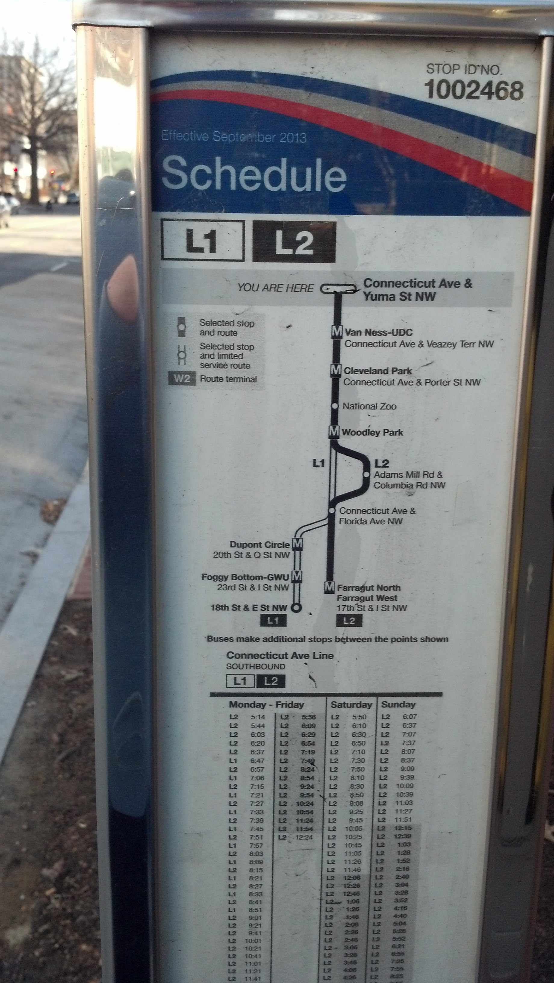 L1/L2: Connecticut Avenue Line
The L1 and L2 buses parallel the Red Line along Connecticut Avenue but are critically important routes to the apartment-dense corridor between downtown and their joint northern terminus at Chevy Chase Circle.
- The L1 bus provides weekday-only service in the peak direction during the morning and afternoon rush periods (southbound in the mornings and northbound in the afternoons) between Chevy Chase Circle and 18th & C streets NW via 20th Street NW & Massachusetts Avenue near the Dupont Circle Station (Red Line), 23rd & I streets NW at the Foggy Bottom Station (Blue/Orange/Silver lines) and the State Department headquarters.
- The L2 bus offers service seven days a week between Chevy Chase Circle at 17th & I streets NW at Farragut Square. The L2 diverges from Connecticut Avenue between Columbia Road and Calvert Street NW to serve the busy Metrobus transfer at 18th Street NW & Columbia Road in Adams Morgan.
- The L2 bus, like the 43 bus, also bypasses Dupont Circle by using the Connecticut Avenue underpass. (Northbound, the L2 runs express from N Street NW to S Street NW. Southbound, the L2 runs express from R Street NW to N Street NW.)
- Depending on the timing, the L2 bus can often be a faster option to locations along Connecticut Avenue if the Red Line is impacted by track work or major disruptions.
» Complete L1 and L2 Route Information [WMATA]
***
M2: Fairfax Village-Naylor Road Line
The M2 bus, like the M6, connects the Fairfax Village neighborhood in Southeast D.C. with the Metrorail system. The weekday-only route circulates clockwise around Fairfax Village on a Suitland Road, 38th Street SE, Alabama Avenue, Pennsylvania Avenue and Southern Avenue before heading to the Naylor Road Station (Green Line) via Branch Avenue & Suitland Road.
» Complete M2 Route Information [WMATA]
***
The weekday-only M4 bus travels most of the length of Nebraska Avenue in Upper Northwest D.C. connecting Pinehurst Circle with Sibley Hospital via the Tenleytown Station (Red Line) and American University.
- Since the M4 doesn’t run on weekends, has less-than-ideal headways and ceases service in the evenings much earlier than most Metrobus lines, this route is not necessarily the most convenient. But it is the only bus in Upper Northwest that connects relatively transit-isolated neighborhoods like the Palisades to Metrorail and links all of the major bus lines west of Rock Creek Park.
- Heading to Sibley Hospitlal by Metrobus on a weekday? Taking the M4 bus from Tenleytown is usually much faster than taking the D6 bus from Dupont Circle, the only other Metrobus route that serves the hospital.
- In the Palisades and Kent neighborhoods, the M4 bus runs in a large loop via Loughboro Road, McArthur Boulevard and Arizona Avenue. If you’re trying to catch the M4 bus at Sibley Hospital, you must continue southbound to MacArthur Boulevard on the loop before returning northward.
- Additional M4 buses run during rush hour but some buses may end service at the Tenleytown Station.
- Sibley-bound M4 buses serve the Tenleytown Station on 40th Street NW north of Albemarle Street, a half block east of the Metrorail station entrance. Pinehurst-bound M4 buses stop across the median on Fort Drive.
» Complete M4 Route Information [WMATA]
***
Like the M2 bus, the M6 connects the Fairfax Village neighborhood in Southeast D.C. with the Metrorail system. This route, which operates seven days a week, circulates clockwise through the Fairfax Village and neighboring Fort Davis on Alabama Avenue, Massachusetts Avenue, Southern Avenue, Suitland Road and 38th Street SE before heading to the Potomac Avenue Station (Blue/Orange/Silver lines) via Pennsylvania Avenue and the John Phillip Sousa Bridge.
» Complete M6 Route Information [WMATA]
***
M8/M9: Congress Heights Shuttle Line
The weekday-only M8 and M9 buses run on the same loop connecting the Congress Heights Station (Green Line) with parts of the Congress Heights and Washington Highlands neighborhoods.
The M8 runs clockwise on the loop while the M9 runs counterclockwise.
These buses run on Alabama Avenue, Wheeler Road, Barnaby Street SE, Chesapeake Street SE, 4th Street SE, Mississippi Avenue, 6th Street SE and Savanna Street SE.
» Complete M8 and M9 Route Information [WMATA]
***
N2/N3/N4/N6: Massachusetts Avenue Line
The N-series buses connect different neighborhoods in Upper Northwest D.C. with downtown via Embassy Row along Massachusetts Avenue. Although all of the N buses share the same terminus at the Friendship Heights Station, each bus has a different service pattern, making the overall bus line operations not so easy to understand.
- The N6 is the only N-bus route to run on weekends. But it also runs after the weekday evening rush hour (including a clockwise loop through the Cathedral Heights and Wesley Heights neighborhoods via Idaho, Cathedral, New Mexico and Nebraska avenues) when all the other N buses cease operation. Outside of that loop, the N6 runs between the Friendship Heights Station and Farragut Square downtown via Western Avenue & River Road, Westmoreland Circle, Ward Circle (at American University), Embassy Row and Dupont Circle. Between Dupont Circle and Farragut Square, the N6 runs southbound on Connecticut Avenue and northbound on 18th Street NW between I and P streets.
- The N2 bus runs Monday-Friday between the Friendship Heights Station and Farragut Square and serves the Cathedral Heights-Wesley Heights loop (via Idaho, Cathedral, New Mexico and Nebraska avenues), in addition to the Tenleytown Station (at Wisconsin Avenue & Albemarle Street NW) via Tenley Circle. The N2 does not serve the Spring Valley neighborhood and skips Western Avenue and Westmoreland Circle, which are served by the N3, N4 and N6 buses. Between Dupont Circle and Farragut Square, the N6, like the N2 and N4 buses, runs southbound on Connecticut Avenue and northbound on 18th Street NW between I and P streets.
- The N3 bus runs only weekdays in the peak direction between the Friendship Heights Station and the Federal Triangle Station (there are just five scheduled southbound trips in the morning and four northbound trips in the afternoons). The N3 bus does not serve Farragut Square like the rest of the N buses but runs to/from the Federal Triangle Station (Blue/Orange/Silver) via the Foggy Bottom Station (Blue/Orange/Silver) and Virginia & Constitution avenues.
- Running between between the Friendship Heights Station and Farragut Square, the N4 bus is nearly identical the N6 bus except that it operates weekdays only. When the N4 ceases operations weekday evenings, the N6 picks up most of its route. Like the N3 and N6, the N4 serves Western Avenue, Westmoreland Circle and the Spring Valley neighborhood. It skips the Wesley Heights loop that’s served by the N2 bus and N6 buses on weekday evenings. Between Dupont Circle and Farragut Square, the N4, like the N2 and N6 buses, runs southbound on Connecticut Avenue and northbound on 18th Street NW between I and P streets.
Confused? I don’t blame you.
» Complete N2, N3, N4 and N6 Route Information …
***
The P6 bus connects the Anacostia Station (Green Line) with the Rhode Island Avenue Station (Red Line) via the 11th Street Bridge, Navy Yard Station (Green Line), Waterfront Station (Green Line) at Third & M streets SW, Archives Station (Yellow/Green lines) at Seventh Street NW & Pennsylvania Avenue, Metro Center Station (Red/Blue/Orange/Silver lines) at 11th & G streets NW, Gallery Place Station (Red/Yellow/Green lines) at Seventh & H streets NW and the Eckington neighborhood (on R, T and Fourth streets NE).
- Some P6 buses — those running after-midnight weekdays and early morning on weekends — only serve the northern section of the route between the Archives Station and Rhode Island Avenue Station.
» Complete P6 Route Information [WMATA]
***
The S-buses on 16th Street NW, which also include the S9 limited-stop MetroExtra line, are among the heaviest used bus routes in the Metrobus system. 16th Street has frequent bus service. During some periods on some sections of the line, buses come every 90 seconds. They not only carry plenty of commuters to/from the Silver Spring Station (Red Line), they also pass through some very apartment-dense neighborhoods north of downtown. Extreme crowding is not uncommon, even well after the traditional evening rush hour. Local officials continue to study ways to improve service, including the possible creation of a bus-only lane on 16th Street to improve service.
Overall, the S-series buses are somewhat hard to explain because certain routes end at different terminal stops while some individual bus trips on certain lines end at different points, too.
- If you’re traveling on 16th Street NW anywhere between Colorado Avenue and K Street NW, it’s fairly simple: All S buses, except for the S9 limited-stop route, serve all stops northbound and southbound.
- The S2 and S4 buses run seven days a week while the S1 bus only runs on weekdays.
- The S1 bus runs only weekdays in the peak direction to/from 22nd Street NW & Virginia Avenue near the State Department (signed as “Potomac Park”) via 18th & K street NW and Farragut Square. Northbound S1 buses end service at 16th Street NW & Colorado Avenue. Southbound buses begin service at either 14th & Decatur streets NW (at the Northern Division bus garage) or 14th Street NW & Missouri Avenue before looping back to 16th Street NW & Military Road before heading downtown on 16th Street NW. (Some S2 buses also start their routes on 14th Street.)
- North of 16th Street NW & Colorado Avenue, the S2 and S4 buses share the same route until 16th Street NW & Alaska Avenue, where the S2 deviates from 16th Street NW to Eastern & Georgia avenues via Alaska Avenue before rejoining the S4 at 16th Street NW & Eastern Avenue.
- South of K Street NW, the S2 and S4 buses run to 10th Street NW & Constitution Avenue, near the Federal Triangle Station (Blue/Orange/Silver lines). Some buses alternatively run to 14th & H streets NW or 13th & I streets NW near the McPherson Square Station (Blue/Orange/Silver lines). Be sure to check the bus destination sign!
- To ease morning crowding south of the Mount Pleasant neighborhood, some southbound S2 buses begin service at 16th & Harvard streets NW.
» Complete S1, S2 and S4 Route Information [WMATA] …
***
Northbound and southbound limited-stop service on 16th Street NW, branded the S9 “MetroExtra” bus, runs only on weekdays between stops near the Silver Spring Station (Red Line) and the McPherson Square Station (Blue/Orange/Silver lines).
Some of the S9’s select stops on 16th Street include Colorado Avenue adjacent to the Carter Barron Park & Ride Lot, Spring Road adjacent to the Woodner Apartments, Irving Street near the Columbia Heights Station (Yellow/Green lines), U Street NW and P Street NW.
» Complete S9 Route Information [WMATA] …
***
U2/U4/U5/U6/U8: Minnesota Avenue-Anacostia Line/Sheriff Road-River Terrace Line/Mayfair-Marshall Heights Line/Capitol Heights-Benning Heights Line
The U-series buses run on routes connecting various neighborhoods east of the Anacostia River in Northeast and Southeast D.C. All of the buses serve the Minnesota Avenue Station (Orange Line) but their individual routes vary.
- The U2 bus, which runs Mondays-Saturdays, serves the majority of the Minnesota Avenue corridor and connects the Minnesota Avenue Station and Anacostia Station (Green Line). In Anacostia, northbound and southbound buses briefly split. Buses bound for Minnesota Avenue (northbound) run via 16th & W streets SE near the Frederick Douglass National Historic Site while buses bound for the Anacostia Station (southbound) run via Good Hope Road & Martin Luther King Jr. Avenue.
- The U4 bus connects 33rd & Ames streets NE in the River Terrace neighborhood with Eastern Avenue & Sheriff Road on the D.C.-Maryland border via Sheriff Road, the Minnesota Avenue Station, Minnesota Avenue and Benning Road. It runs seven days a week with more infrequent service (roughly every 30 minutes) on weekends.
- The U5 and U6 buses run on roughly the same route, which loops through different neighborhoods and connects the Minnesota Avenue Station (Orange Line) and Benning Road Station (Blue/Silver lines). These buses run seven days a week and connect the Mayfair, Lincoln Heights, Benning Heights, Marshall Heights and Capitol View neighborhoods via Minnesota Avenue, Ridge Road, Texas Avenue, East Capitol Street, 51st Street NE, 51st Street SE and 53rd Street SE.
- The U8 bus runs seven days a week and connects the Minnesota Avenue Station, Benning Road Station and Capitol Heights Station via Benning Road and Nannie Helen Burroughs Avenue.
***
V5: Fairfax Village-L’Enfant Plaza Line
The V5 bus connects the Fairfax Village neighborhood in Southeast D.C. with the L’Enfant Plaza Station (Blue/Orange/Silver/Yellow/Green lines) via Alabama Avenue, Good Hope Road, 11th Street Bridge and the Southeast-Southwest Freeway.
It runs weekdays only in the peak direction with 12 scheduled trips to L’Enfant Plaza in the mornings and 10 scheduled trips to Fairfax Village in the afternoons.
» Complete V5 Route Information [WMATA]
***
V7/V8/V9: Minnesota Avenue-M Street Line
The V7 and V9 buses connect neighborhoods east of the Anacostia River in Northeast and Southeast D.C. to the Bureau of Engraving and Printing at 14th & C streets SW via Minnesota Avenue, the John Phillip Sousa Bridge, the Potomac Avenue Station (Blue/Orange/Silver lines), the Navy Yard Station (Green Line), the Waterfront Station (Green Line) and the L’Enfant Plaza Station (Blue/Orange/Silver/Yellow/Green lines).
- The V7’s east-of-the-Anacostia terminus is at the Deanwood Station (Orange Line). The V7 also serves the Minnesota Avenue Station (Orange Line).
- The V9’s east-of-the-Anacostia terminus is in Benning Heights. It starts westbound service at Benning Road & Hanna Place SE and ends eastbound service at H Street SE & Hanna Place.
- The V8 bus takes the place of the V7 and V9 buses on the weekends and has its downtown terminus at 9th Street NW & Constitution Avenue near the Archives Station (Yellow/Green lines). The V8 bus, however, only serves the V7’s terminus at the Deanwood Station and does not travel along the V9’s route to/from Benning Heights.
» Complete V7, V8 and V9 Route Information [WMATA]
***
W2/W3: United Medical Center-Anacostia Line
The W2 and W3 buses might take the prize for the most neighborhood twists and turns. There’s no simple way to explain their schedules or seemingly identical routes through the various neighborhoods served east of the Anacostia River in Southeast D.C. Generally, these two routes connect the Anacostia Station (Green Line) with the United Medical Center. (Some buses stop directly at the medical center while others stop nearby on Southern Avenue.) Most, but not all, buses serve the Congress Heights Station (Green Line). A few select buses stop at the Southern Avenue Station.
I feel bad for new bus drivers trying to learn the many quirks and turns of the W2 and W3 routes. (These buses travel on roughly 50 different streets per trip!) Consult the schedule for the specifics …
» Complete W2 and W3 Route Information [WMATA] …
***
W4: Deanwood-Alabama Avenue Line
This route, which runs seven days a week, connects the Deanwood Station (Orange Line) and Anacostia Station (Green Line) via the Benning Road Station (Blue/Silver lines), the Skyland Center at Alabama Avenue & Naylor Road and the Congress Heights Station (Green Line). Three afternoon trips on weekdays are scheduled to terminate at Malcolm X and Martin Luther King Jr. avenues.
» Complete W4 Route Information [WMATA]
***
W6/W8: Garfield-Anacostia Loop Line
The W6 and W8 buses run in a loop connecting the Anacostia Station (Green Line) to various surrounding neighborhoods along Stanton Road, Morris Road, Alabama Avenue and Good Hope Road and includes some diversions into different apartment house communities. The W6 bus runs clockwise along the loop while the W8 bus runs counter-clockwise.
» Complete W6 and W8 Route Information [WMATA]
W9: L’Enfant Plaza-Coast Guard Limited Line
The W9 bus is a limited-stop “MetroExtra” line running between the L’Enfant Plaza Station (Blue/Orange/Silver/Yellow/Green lines) and the Coast Guard headquarters (at St. Elizabeths Gate 4) with some extended service to South Capitol Street & Southern Avenue. The peak direction for the W9 line is reversed. It runs from L’Enfant Plaza in the morning and to L’Enfant Plaza in the afternoon.
» Complete W9 Route Information [WMATA]
***
The X1 and X3 buses run only on weekdays in the peak direction, westbound from their joint eastern terminus at the Minnesota Avenue Station (Orange Line) and eastbound toward Minnesota Avenue Station in the afternoons.
- The X1 has its western terminus at the Foggy Bottom Station (Blue/Orange/Silver lines) and travels along Benning Road, H Street NE, North Capitol Street, Louisiana Avenue, Constitution Avenue and Virginia Avenue.
- The X3 has its western terminus at the Tenleytown Station (Red Line) in Upper Northwest D.C. and travels along Benning Road, Florida Avenue, U Street NW, 18th Street NW in the Adams Morgan neighborhood, Calvert Street NW through the Woodley Park neighborhood and onward to Tenleytown following the route of the 96 bus.
- Because the X1 and X3 buses have limited service hours — combined, the routes only have 17 scheduled westbound trips and 12 scheduled eastbound trips — they have limited use but are useful for some bus commuters in the Benning Road corridor to reach points downtown or Upper Northwest.
» Complete X1 and X3 Route Information [WMATA]
X2: H Street-Benning Road Line
The X2 bus is a high-frequency route running seven days a week connecting Lafayette Square near the White House with the Minnesota Avenue Station (Orange Line) via the Gallery Place Station (Red/Yellow/Green lines) at Seventh & H streets NW, the back side of Union Station (Red Line) adjacent to the western terminus of the H Street-Benning Road streetcar line and the Starburst intersection where H Street NE, Benning Road, Maryland Avenue, Florida Avenue and Bladensburg Road meet.
- The soon-to-open H Street-Benning Road streetcar line will supplement service along the X2 route between Union Station and Oklahoma Avenue.
- The X2 is among the few Metrobus routes to offer nearly 24-hour service.
- Eastbound X2 service to the H Street NE corridor can get particularly crowded starting at the Gallery Place Station. Board the bus west of Seventh Street NW to have a better chance of getting a seat.
» Complete X2 Route Information [WMATA]
The X8 bus connects the Carver Terrace neighborhood in Northeast D.C. with Union Station (Red Line) via Maryland Avenue, Stanton Park and Massachusetts Avenue.
- The western terminus near Union Station is on Massachusetts Avenue opposite the National Postal Museum. The eastern terminus is at 21st Place NE and Maryland Avenue. (Although this terminus is adjacent to the southern boundary of the National Arboretum, there is no immediate neighborhood access to the National Arboretum. Use the B2 bus instead.)
- The X8 bus operates seven days a week and is scheduled to run every 40 minutes with more frequency during rush hour.
» Complete X8 Route Information
X9: H Street-Benning Road Limited Line
The X9 limited-stop bus route, branded as a “MetroExtra” line, connects the Capitol Heights Station (Blue/Silver lines) with 12th Street NW & New York Avenue near the Metro Center Station (Red/Blue/Orange/Silver lines) via Nannie Helen Burroughs Avenue, the Minnesota Avenue Station (Orange Line), Benning Road, H Street NE, H Street NW and the Gallery Place Station (Red/Yellow/Green lines).
- This limited-stop line runs during the morning and afternoon rush hours in both directions.
- Some key stops include 8th & H streets NE, North Capitol & H streets and 7th & H streets NW.
» Complete X9 Route Information [WMATA]
***
D.C. CIRCULATOR ROUTES:
The D.C. Circulator is a five-line bus system operated through a public-private partnership from the D.C. Department of Transportation, the Washington Metropolitan Area Transit Authority (the organization that operates Metrobus and Metrorail) and D.C. Surface Transit Inc. Circulator routes are meant to connect downtown D.C. with entertainment corridors, landmarks and other important local destinations and create transit connections to complement existing Metrobus service.
The distinctive red-colored buses run roughly every 10 minutes, make limited stops and fares are only $1. These buses are popular with tourists and can be incredibly useful for local residents as well.
The five routes are not numbered and are referred to by neighborhood or destination served:
Georgetown-Union Station: This route, not surprisingly, connects Georgetown with Union Station (Red Line).
- Its western terminus, near Wisconsin Avenue & Whitehaven Parkway, is adjacent to the Georgetown Safeway grocery store and Georgetown’s Sunday flea market and is also within walking distance of the Burleith and Glover Park neighborhoods.
- This route travels to the heart of Georgetown’s shopping district at Wisconsin Avenue & M Street NW, through the heart of the K Street NW commercial corridor via Farragut Square, McPherson Square and Franklin Square (where it intersects the Woodley Park-Adams Morgan-McPherson Square Circulator route), has stops at Mount Vernon Square near the Walter E. Washington Convention Center.
- The route’s eastern terminus is located in the Union Station parking garage, but the route intersects the Union Station-Navy Yard Circulator route in the vicinity of Massachusetts Avenue & E Street NE, adjacent to the National Postal Museum and Columbus Circle.
- The one slightly confusing aspect to this route is where the routes of eastbound and westbound buses diverge between Washington Circle in Foggy Bottom and Wisconsin Avenue & M Street NW in Georgetown. Westbound buses follow K Street NW to the Georgetown waterfront (with stops at 30th & K streets NW and Wisconsin Avenue & K Street NW) while eastbound buses follow M Street NW to Pennsylvania Avenue (with stops at Wisconsin Avenue & M Street NW, Thomas Jefferson & M streets NW, 28th Street NW & Pennsylvania Avenue immediately outside the Four Seasons Hotel, 26th Street NW & Pennsylvania Avenue and 24th Street NW & Pennsylvania Avenue).
» Complete Georgetown-Union Station Route Information [D.C. Circulator]
***
Dupont Circle-Georgetown-Rosslyn: This route provides the only direct connection between the Dupont Circle Station (Red Line) and the heart of Georgetown at Wisconsin Avenue & M Street NW with additional connections to the Rosslyn Station (Blue/Orange/Silver lines) via the Key Bridge.
- The eastern terminus is located on 19th & N streets NW, just south of the Dupont Circle Station’s south entrance on 19th Street.
- Heading westbound, this route travels along New Hampshire Avenue and M Street NW into Georgetown and the crosses the Potomac River to the Rosslyn Station on the Key Bridge.
- The western terminus is at 19th Street N. & N. Moore Street, about one block north of the Rosslyn Station entrance on N. Moore Street.
- Heading eastbound toward Dupont Circle, this route travels along M Street NW to Pennsylvania Avenue and then to L Street NW to New Hampshire Avenue to the Dupont terminus at 19th & N streets NW.
- For eastbound service along M Street, be sure to look at bus destination signs since two Circulator routes serve the same stops at Wisconsin & M streets NW, Thomas Jefferson & M streets NW and 28th Street NW & Pennsylvania Avenue immediately outside the Four Seasons Hotel.
» Complete Dupont Circle-Georgetown-Rosslyn Route Information [D.C. Circulator]
***
Woodley Park-Adams Morgan-McPherson Square:
- This upside-down L-shaped route can be a convenient way to reach Adams Morgan, Columbia Heights and the heart of the booming corridors along 14th Street NW and U Street NW. And with limited stops along 14th Street, it can sometimes be a very quick trip.
- The northern/western terminus at the Woodley Park Station (Red Line) is located at 24th Street NW & Connecticut Avenue, adjacent to the Metrorail entrance and near the Marriott Wardman Park Hotel.
- McPherson-bound Circulator buses do not stop directly in the heart of the Adams Morgan neighborhood at 18th Street NW & Columbia Road. Look for nearby Circulator stops at Calvert Street NW & Adams Mill Road and Columbia Road & Ontario Road.
- McPherson-bound buses from Woodley Park and Adams Morgan stop immediately adjacent to the Columbia Heights Station (Yellow/Green lines) at 14th & Irving streets NW. Woodley-bound buses from McPherson Square and 14th Street NW stop one block south on Columbia Road, just west of 14th Street NW.
- Circulator buses traveling through the heart of the 14th Street corridor stop at U Street NW and P Street NW.
- Although this route serves the McPherson Square Station (Blue/Orange/Silver lines), it does not stop directly at McPherson Square itself. Buses terminate at Franklin Square near the eastern entrance to the McPherson Square station at 14th & I streets NW.
» Complete Woodley Park-Adams Morgan-McPherson Square Route Information [D.C. Circulator]
***
This route doesn’t necessarily offer the most direct route between Union Station (Red Line) and the Navy Yard Station (Green Line), but it does offer the only direct bus connection between Union Station, Capitol Hill and the Eastern Market Station (Blue/Orange/Silver lines), via First Street NE & Constitution Avenue, First Street SE & Independence Avenue and 8th Street SE & Pennsylvania Avenue.
- This route doesn’t serve the Georgetown-Union Station Circulator route’s stop in the Union Station parking garage, but does intersect the crosstown route in the vicinity of Massachusetts Avenue & E Street NE, adjacent to the National Postal Museum and Columbus Circle.
- This route also serves the Barracks Row commercial district on 8th Street SE and stops near Nationals Park.
- During home games, this Circulator route can be quite handy for reaching Union Station and the Red Line without having to battle pre- and post-game crowds on the Green Line and at the Navy Yard Station.
» Complete Union Station-Navy Yard Route Information [D.C. Circulator]
***
This is the only Circulator route to cross the Anacostia River. This route has its western terminus at the Potomac Avenue Station (Blue/Orange/Silver lines) and travels to the Skyland shopping center at Naylor Road & Good Hope Road via Barracks Row on 8th Street SE, the Anacostia Station (Green Line) and historic Anacostia at Good Hope Road and Martin Luther King Jr. Avenue.
» Complete Potomac Avenue-Skyland Route Information [D.C. Circulator]